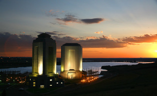
Fort Peck Dam and Lake
Helpful links below.
https://www.visitmt.com/listings/general/lake/fort-peck-lake-reservoir-and-recreation-area.html
http://www.fortpeckdam.com/
http://en.wikipedia.org/wiki/Fort_Peck_Lake
More than 50 different kinds of fish swim in Fort Peck Reservoir, Montana's largest body of water. The lake is about 134 miles in length and has a maximum depth of 220 feet when full. There are over 1,520 miles of shoreline, longer than the California coast. The reservoir was created from 1933 through 1937 by constructing a 3.8 mile-long dam across the Missouri River. Some of the hotly pursued species include walleye (a priority among the serious anglers!), northern pike, paddlefish, sauger, lake trout, small mouth bass and chinook salmon. A paved road for larger vehicles provides direct access to the reservoir at Fort Peck Marina, located near the west side of the dam. Other access roads are gravel and/or dirt, leading to Hell Creek Bay, 26 miles north of Jordan, and one on the south fork of Rock Creek Bay, about 10 miles west of Highway 24. All marinas include concrete boat ramps.
Surrounding this large expanse of water is the Charles M. Russell (CMR) National Wildlife Refuge, managed by the US Fish and Wildlife Service, which provides over one million acres of public land for fishing, hiking, hunting, camping, bird-watching, and other outdoor recreation. Need to check the weather before accessing the reservoir's dirt roads as they can become impassable when wet.
According to the World Almanac, Fort Peck Dam, MT is the largest embankment dam in the United States with the fifth-largest man-made reservoir. The vast size of Fort Peck Lake and its remoteness from major population centers provides a variety of high quality outdoor experiences including camping, boating, fishing, hunting, sightseeing, and wildlife viewing. This project has 19 recreation areas.
GPS Coordinates
Latitude
48° 0' 8.1648" N
Longitude
106° 25' 3.5652" W
From Glasgow, MT, take Highway 24 south 17 miles to Fort Peck. Or from Nashua, MT take Highway 117 south 12 miles to Fort Peck.